57.628107264
3.5709125
327
Northeast Greenland Extreme
From Akureyri to Longyearbyen via Scoresby Sund, Kong Oscar Fjord and the shifting sea ice edge.
This expedition voyage of 14 days/13 nights takes you from North Iceland to the rugged coast of Northeast Greenland, into Scoresby Sund and onward into high Arctic waters, before finishing in Spitsbergen.
Tour ID: 1830748 Greenland, Spitzbergen, Iceland, Arctic, Bear Island, East Greenland, Svalbard Archipelago, Arctic Ocean, High Arctic, Arctic Circle, Kalaallit Nunaat, Scoresby Sund, Ittoqqortoormiit, Thule Region, Northeast Greenland National Park ●●●●● 160 Reviews
10 days / 9 nights
Expedition ship m/v Hondius, m/v Plancius
Scoresby Sund the world’s largest fjord
Ittoqqortoormiit East Greenland settlement
Kong Oscar Fjord and Alpefjord
Historic islands of early polar expeditions
Chances for whales, seals, musk oxen & polar bears

Northeast Greenland Extreme: The itinerary
Day 1: Start in Reykjavík and embarkation in Akureyri
Your journey begins in the morning in Reykjavík. If you wish, you can join a chartered bus transfer from the bus stop at Harpa Concert Hall and Conference Centre in Austurbakki to the ship in Akureyri, the embarkation port. The drive takes about six hours across North Iceland, arriving in Akureyri in the afternoon. Please note that this transfer must be booked and paid in advance. After embarkation on MS Plancius you have time to settle in and become familiar with the routines of an expedition voyage. In the early evening the ship departs Akureyri. Whales are often seen near the fjord mouth, so sightings are possible already on this first leg. During the night you cross the Arctic Circle while the ship sets course for East Greenland.
Day 2: Sea day toward East Greenland with first icebergs in the evening
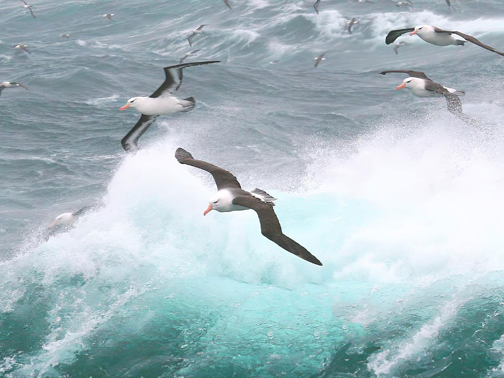
As you sail north, seabirds are likely to accompany the ship, including northern fulmars, black legged kittiwakes, gannets and guillemots. Whale sightings are also possible, depending on weather and visibility. This is a transit day on open water, offering time to observe how light, temperature and sea conditions change as you move into higher latitudes. By evening the first icebergs come into view as the ship approaches the East Greenland coast near Cape Brewster. With the appearance of icebergs the seascape becomes more structured and navigation increasingly involves ice awareness. The approach to the coast marks the transition from the crossing to the expedition area itself.
All pictures of this partner


Day 3: Arrival in Scoresby Sund with glaciated coasts and Zodiac options
Today you reach Scoresby Sund, the largest fjord system on Earth, and sail along the glaciated shoreline of Volquart Boons Kyst. The fjord passage is characterised by steep shores, ice formations and changing perspectives as the ship follows the fjord’s bends. Depending on conditions, a Zodiac cruise may take place along one of the glacier fronts to view the scale and texture of the ice at close range. A visit to Vikingebugt is also possible, where basalt columns and distinctive ice formations shape the scenery. In the afternoon you sail along the east coast of Milne Land, passing a large number of massive icebergs that often occur in high density here. If a landing at Charcot Havn is possible, a walk to the Charcot Glacier is planned. Afterwards the ship continues toward Bjørneøer, a small island group known in English as the Bear Islands.
Day 4: Icebergs near Sydkap and a long hike to Nordøstbugt
In the morning you are likely to encounter very large icebergs, some rising more than 100 metres and extending over a kilometre in length. Many are grounded because the fjord is only about 400 metres deep in places. A landing is then planned near Sydkap, offering views over Hall Bredning and good chances to see Arctic hares. The day also features a long hike from Sydkap to Nordøstbugt, about 12 km to the northeast, reaching the mouth of the river Holger Danskes Briller. The plan is to continue along the shore south to Satakajik, where you can see whale vertebrae and the remains of Thule summer houses. Guests who do not wish to join the long hike will rejoin the group at this location for the second excursion of the day.
Day 5: Ittoqqortoormiit and northbound sailing past Liverpool Land
In the morning you call at Ittoqqortoormiit, the only settlement in Scoresby Sund, with around four hundred inhabitants. The visit allows time to walk through the small community. At the post office you can buy stamps for postcards, and around the settlement you may see sled dogs and dried skins of seals, polar bears and musk oxen, offering insight into local practices. In the afternoon MS Plancius continues north, passing the coastal landscapes of Liverpool Land with their changing forms and colours. During the night the ship enters Kong Oscar Fjord, beginning the next stage of the voyage into more northerly fjord systems.
Day 6: Segelsällskapets Fjord or Alpefjord with a Zodiac cruise near Gully Glacier
Today you enter Segelsällskapets Fjord, with the striped slopes of the Berzelius Mountains along the northern side. A landing is planned on the southern shore, where ancient sedimentary formations are visible underfoot. A hike leads toward a small lake with good chances to see musk oxen, Arctic hares and ptarmigan. Alternatively, the ship may proceed into Alpefjord, named for the sharply pointed peaks rising around it. In that case a Zodiac cruise is planned around Gully Glacier, which once restricted access to the inner waters. The farther you move into the fjord, the more the landscape is defined by steep walls, ice and the fjord’s narrowing profile. Which option is chosen depends on conditions and expedition planning.
Day 7: Islands in Antarctic Sound and sailing through Kaiser Franz Joseph Fjord
Early in the morning you pass the islands of Ruth, Maria and Ella. You then reach Teufelschloss, a mountain notable for its striking layered geology, clearly visible from the ship. Blomsterbugt and the intended landing site lie on the opposite side of the fjord, so a landing may be possible depending on conditions. In the afternoon you sail among icebergs through the majestic Kaiser Franz Joseph Fjord, where large drifting and grounded bergs often dominate the scene. The route continues into Mackenzie Bugt, with navigation continuously adjusted to the distribution of ice. The day combines prominent geological features, potential time ashore and extended fjord cruising in iceberg rich waters.
Day 8: Eskimonaes and traces of Thule culture
Today you hope to land at Eskimonaes on the south shore of Clavering Ø. The site is associated with Douglas Clavering, who in 1823 encountered a small group of people of the Thule culture here. This group is considered the only living Thule people ever recorded in Northeast Greenland. Traces of their presence can be found across Greenland and provide insight into earlier use of this region. A landing allows you to connect the landscape with its cultural historical context, though the exact plan depends on weather, ice and landing conditions. The day is therefore centred on a location defined more by its historical significance than by any infrastructure.
Day 9: Islands of polar history, Sabine Ø and Bass Rock
From early morning until late evening you sail past a series of islands closely linked to the history of early polar exploration. These include Sabine Ø and Bass Rock, also known as the Pendulum Islands. Here Edward Sabine carried out his pendulum experiments in 1823, and huts of the Baldwin Ziegler Polar Expedition were established in the area. The day is primarily a long passage, with the islands viewed from the ship while guides provide historical context. The landscape in these latitudes often appears more open and austere, and observation focuses on shorelines, possible wildlife activity and the traces of human presence in an otherwise remote region. During the night you pass Shannon Ø, continuing into higher Arctic waters.
Day 10: Koldewey with possible landings at Cape Alf Trolle or Cape Ahrend
Today you reach Koldewey, a long island named by the second German polar expedition under Koldewey in 1869 to 1870. The plan is to attempt a landing at the historic Cape Alf Trolle or Cape Ahrend. You are now within a high Arctic climate regime, and the landscape becomes flatter and more rounded than farther south, with less alpine character. On the onward course you may encounter heavier sea ice, which can affect landing plans. Proposed landing sites may have to be abandoned due to ice, while others may remain accessible. This is therefore a flexible expedition day, focused on reaching historically named points while observing changing ice and landscape conditions.
Day 11: Germania Land, potential landings and wildlife conditions
Possible landings are planned in Germania Land, for example at Thoms Thomsen Næs, Fyrretyvekilometersnaesset or another suitable site. This region is known for musk oxen, and a solitary wolf is sometimes seen. The exact landing location depends on ice and weather as well as current wildlife conditions. Planning balances safe access with the opportunity to experience the characteristic tundra and coastal landscape of this part of Northeast Greenland. Seabirds and shoreline structure also play a role, as activity often concentrates in the transition zones between land, shallow water and ice. The day remains an expedition segment where the final decision is made on site.
Day 12: Through or along the sea ice edge with a focus on marine mammals
As you sail east through and along the rugged margin of Northeast Greenland sea ice, the focus is on wildlife watching. The expedition scans for whales, seals, polar bears and migrating seabirds that use this zone as a feeding and travel corridor. The landscape is in constant motion, as drift ice, wind and currents continuously reshape the ice edge. This creates changing boundaries between open water and ice that are often highly productive for many Arctic species. From a navigation perspective, course and speed must be adapted to ice conditions, while observation periods are used whenever suitable opportunities arise. The day is therefore strongly shaped by ice dynamics rather than fixed points on land.
Day 13: Crossing toward Spitsbergen with a possible late landing at Poolepynten
On open sea you now sail east toward Spitsbergen, influenced by the northernmost branch of the warm Gulf Stream. This passage links Greenland waters with the Svalbard archipelago and is planned as a longer sea day, with continued watch for marine mammals and seabirds. If time allows, a late evening landing is planned at the walrus haul out site at Poolepynten. The area is known for walrus that may be present on shore, though the feasibility of landing depends on conditions and timing. In any case, this day marks the transition from Greenland’s coast to Svalbard waters, often with different currents, light conditions and ice patterns.
Day 14: Arrival in Longyearbyen and disembarkation
You arrive in Longyearbyen, the administrative centre of Spitsbergen. The package ends after breakfast on board with disembarkation. Depending on your plans you may take a walk through the former mining town, where the parish church and the Svalbard Museum are notable sights, or you may continue your onward travel, for example on an early flight to Oslo.
Included Northeast Greenland Extreme
- Free use of rubber boots and snowshoes
- Complimentary Wi-Fi: each guest receives 1.5 GB of data per day, renewed every 24 hours
- Complimentary Dopper water bottle for use during and after your expedition
Additional Information for Expedition Cruises: The itinerary and route described are provided as examples only and may be adjusted or changed at any time due to weather, ice and tidal conditions, as well as for safety reasons. Specific landing sites, locations or route sections therefore cannot be guaranteed. The captain and expedition leader will make all final decisions regarding the route, landings and daily programme on site. Wildlife sightings cannot be guaranteed. Landings and Zodiac excursions depend on local conditions and regulatory requirements. Optional activities have very limited availability; we recommend booking them well in advance, often weeks or months before departure, as they may be fully booked by the time of travel; their operation depends on weather, ice and safety conditions as well as minimum participation. Polar regions are remote and dynamic natural environments, therefore programme changes or delays may occur.


.jpg_Julian Bourse.jpeg)


.jpg_Ignacio Marino.jpeg)


.jpg_Martin van Lokven.jpeg)
.jpg_Martin van Lokven.jpeg)
.jpg_Martin van Lokven.jpeg)


These pictures provide a general impression of our local partner and the surrounding area. Please note that selected tour may differ from these pictures.
All Reviews of Oceanwide Expeditions
●●●●● 4.6 of 5 Stars (160 Reviews) on
Help us and submit a new review
Please select between 1 to 5 to review the operator* ○○○○○
Sat. 15.08.2026 - Fri. 28.08.2026
14 days from Akureyri, Iceland
Fully booked.
14 days from Akureyri, Iceland
Fully booked.
from €7900,-


Tue. 25.08.2026 - Mon. 07.09.2026
14 days from Akureyri, Iceland
Fully booked.
14 days from Akureyri, Iceland
Fully booked.
from €7200,-


Mon. 26.07.2027 - Mon. 09.08.2027
15 days from Longyearbyen, Svalbard
Available on request
15 days from Longyearbyen, Svalbard
Available on request
from €8150,-

Available on request
from €8150,-
Deck: 3 15m² Shared Occupancy Quad Double Porthole

Available on request
from €9850,-
Deck: 3 16m² Shared Occupancy Triple Double Porthole

Available on request
from €11400,-
Deck: 3 13m² Twin Beds Double Porthole

Available on request
from €12550,-
Deck: 4 12m² Twin Beds Standard Window

Available on request
from €13400,-
Deck: 6 19m² Twin Beds Panoramic Window

Available on request
from €14800,-
Deck: 6 21m² Twin Beds Panoramic Window
All prices per person in double or multi-bed category. Single room surcharges, children's price advantages etc. on request.
Fixed travel dates, additional days on demand.
Fixed travel dates, additional days on demand.